

Case Study · Surrey, BC
13,329 sq ft Industrial Warehouse
An office and warehouse building on Holt Road in Surrey, scanned for the Cushman & Wakefield listing team in a single site visit and delivered as measured floor plans, verified clear heights, CAD files and a walkable 3D tour.
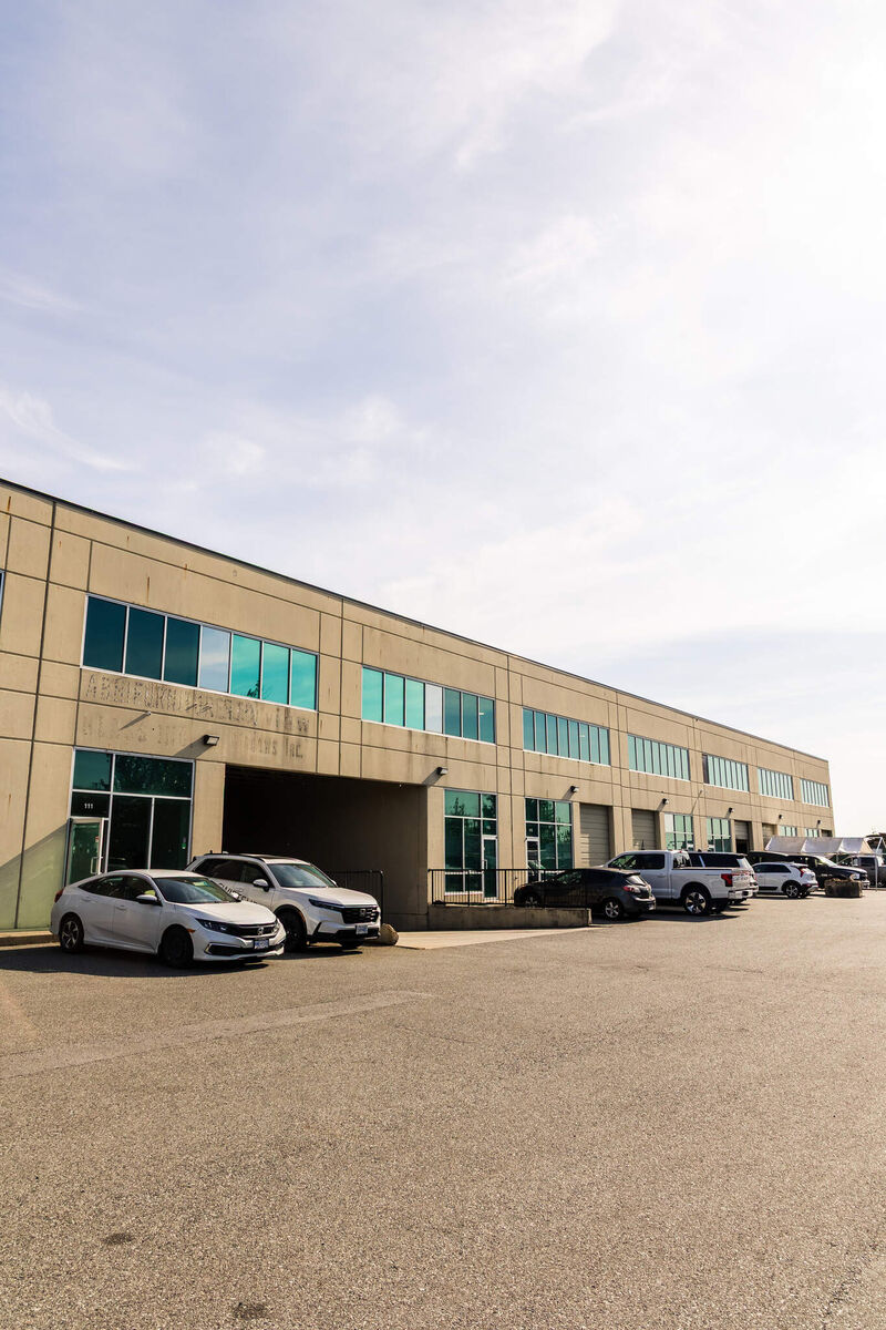
The building
8952 Holt Road is a single-storey office and warehouse building in Surrey, British Columbia, of the type that makes up much of the industrial stock through the Surrey, Delta and Langley corridor. Large clear-span floor plate, a loading dock, and a finished office area at the front.
The building was being brought to market by Cushman & Wakefield, one of the largest commercial real estate firms in the world, and the brief was the one that comes up on almost every industrial listing: give a prospective tenant numbers they can rely on without sending somebody back to site every time a question comes up.
Buildings like this are exactly where hand measurement performs worst. The main floor runs continuously for a long distance, so accumulated error over a tape run is a real problem, and the numbers that matter most to a prospective tenant are the ones that are hardest to take by hand: clear height to the underside of structure, and total usable floor area.
What the survey established
Every figure below was measured from the LiDAR capture rather than taken from an existing drawing.
- Total finished area
- 13,329 sq ft
- Main warehouse floor
- 12,202 sq ft
- Property type
- Office / warehouse
- Levels
- Single-storey
- Height · roof deck27 ft (nominal)
- Height · I-beam25 ft (nominal)
- Height · open steel web joists23 ft (nominal)
- Office / hallway ceiling9 ft (nominal)
- Washroom ceiling8 ft (nominal)
Why three different clear heights
In an industrial building there is no single ceiling height, and quoting one number is how disputes start. The roof deck, the I-beams and the open steel web joists all sit at different elevations, and which one governs depends entirely on what the tenant intends to put underneath. Racking, a crane, a mezzanine and a sprinkler layout each answer to a different one of those figures, so the survey records all three separately.
- Height · roof deck27 ft (nominal)
- Height · I-beam25 ft (nominal)
- Height · open steel web joists23 ft (nominal)
- Office / hallway ceiling9 ft (nominal)
- Washroom ceiling8 ft (nominal)
The space
Photography captured during the same visit as the scan.
The drawings
Floor plans drafted from the measured point cloud, including the room-by-room breakdown and a statement of how the space was measured.
How the project ran
One site visit
The building was captured with an iGUIDE PLANIX, pairing integrated LiDAR with a 60MP 360° camera. Measurements, 360° imagery and listing photography all came out of the same visit.
Areas derived from the point cloud
Floor areas were calculated from the measured data rather than scaled off an existing drawing, and the method used was stated on the deliverable so the figures can be checked.
Heights recorded separately
Roof deck, I-beam and joist heights were each recorded on their own, along with finished ceiling heights in the office and washrooms.
Delivered as a package
Measured floor plans, a room-by-room area breakdown, CAD files and an iGUIDE 3D tour, all reachable from a single link.
Walk the building yourself
The iGUIDE tour from this project is public. You can move through the space, look around, and take your own measurements in the browser.
Opens youriguide.com in a new tab.
What made the difference
For an industrial listing, the questions a prospective tenant asks are almost always dimensional. How much clear height is there, really. Will my racking fit under the joists. What is the actual floor area, as opposed to the number on the brochure.
Answering those from a measured dataset rather than an estimate means the answer holds up. It also means the answer is available immediately, without booking another site visit every time a new question comes up, because the building has already been recorded in full.
For a listing team that matters twice over. A measured set answers tenant questions on the spot, and the same package carries straight through to whoever takes the space, because the drawings a new tenant needs for their fit-out already exist.
Common questions
A height marked nominal is a rounded working figure suitable for assessing whether a space suits a use. For dimensions that will be built or fabricated against, the CAD and BIM deliverables carry the precise measured geometry. Labelling which is which prevents somebody building off a number that was never intended to carry that weight.
A large open industrial floor plate is comparatively quick per square foot, because the scanner covers a lot of area from each position. Subdivided office space is slower for the same area, since it needs more setups. The finished office portion of a building like this takes a disproportionate share of the time.
Yes. Measuring several buildings in one engagement means every property is captured the same way to the same standard, which makes the resulting areas and heights genuinely comparable across the portfolio.
Yes. A listing scan produces the marketing assets and the technical record in the same visit: photography and a 3D tour for the listing itself, and measured plans, areas and clear heights for the tenant questions that follow. This project was captured for a Cushman & Wakefield industrial listing on that basis.
Yes. Layered AutoCAD .dwg is a standard deliverable, and a Revit model is available where the project calls for BIM.
Keep reading
Document your building the same way
Book online with an instant estimate. One visit produces the plans, the areas, the CAD and the tour.