

Guide · Capture Platforms
iGUIDE vs Matterport for Commercial Buildings
Most comparisons of iGUIDE and Matterport are written for residential listings, where the tour is the product and the question is which one sells a house better. A commercial building asks different questions. Somebody needs an area figure that can sit beside a lease, a design team needs files it can draw over, and the record has to still be reachable years into a tenancy. This guide lines the two platforms up against those questions, using only what each company publishes about its own products — and explains why, for commercial work, we chose iGUIDE.
The short answer: iGUIDE, for most commercial buildings
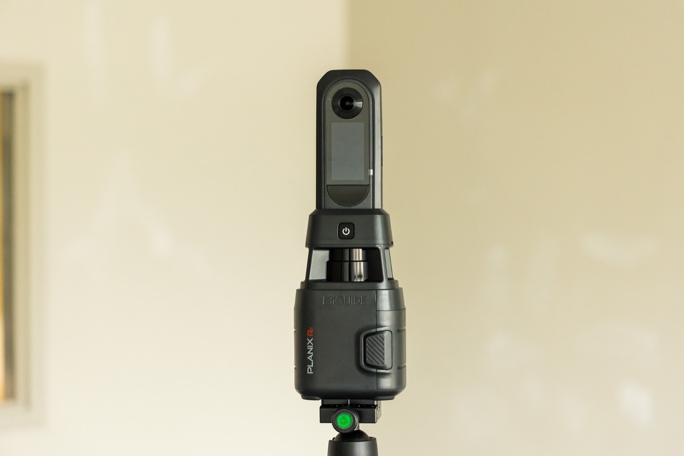
We scan with an iGUIDE PLANIX, and we chose it on purpose. Both platforms pair LiDAR with 360° imagery on a tripod, and both can lead to a measured floor plan, a CAD file and a Revit model. The differences that matter for a commercial building are commercial rather than optical, and they favour iGUIDE. iGUIDE sells per project and includes floor plans in its standard packages. Matterport sells subscriptions capped by the number of active spaces, and sells floor plans and design files as add-ons. For a building record that has to last a lease term, that makes iGUIDE the simpler and more durable choice. The measurement standards iGUIDE names are residential ones, so neither platform's automatic square footage should be treated as a lease area. And for most commercial work, the drawing depends more on who drafts it than on which camera captured the space.
Why the commercial version of this question is different
Search for iGUIDE versus Matterport and most of what comes back is written by and for residential photographers. That makes sense, because a residential listing is where both products started. The tour goes on the listing, the floor plan goes in the brochure, and the listing is gone within a few months. In that world the questions are about how the tour looks, how quickly it is ready, and what each one costs per house.
A commercial building uses the same capture for different jobs. A leasing agent wants a tour that shows a vacancy to a tenant who cannot visit. A landlord wants a floor area that can be compared with the one in the lease. An architect or interior designer wants a file they can draw a fit-out over. A property manager wants a record they can still open in five years, when the next tenant's contractor asks what is above the ceiling. The tour is one of those things, and often not the most important.
So this guide skips the questions residential comparisons dwell on, such as which viewer feels nicer. That is a matter of taste, and the only fair test is to open a sample of each. It concentrates on four things that decide whether the capture is useful to a commercial owner or design team: what the floor plan is and what area basis sits behind it, which design files are available, how the pricing works, and where the record lives once the job is over.
What each company publishes about its own product
Each cell is drawn from that company's own website. Neither column repeats what either company says about the other.
| Question | iGUIDE | Matterport |
|---|---|---|
| Capture instrument | iGUIDEPLANIX R1: LiDAR paired with a 60MP 360° camera, tripod-mounted and moved room by room. | MatterportPro3: LiDAR paired with 360° imagery, tripod-mounted. Its plans also support other compatible cameras, with full camera compatibility from the Professional tier. |
| Published accuracy | iGUIDETypically ±10mm camera-to-wall on walls 60cm or longer, and ±25mm across the raw point cloud (spec sheet). Floor plan distances 0.5% or better, square footage 1% or better. | MatterportPro3: ±20mm at 10m for raw depth. MatterPak point cloud described as accurate to within 1% of reality. |
| Floor plans | iGUIDEIncluded in its Standard package and above: colour-coded schematic PDF with room labels, measurements and square footage. | MatterportSchematic floor plans generated from the 3D tour, listed on its plans page as charged separately. Expedited turnaround from the Professional tier. |
| Measurement standard named | iGUIDEANSI Z765-2021 and RECA RMS 2017. Both are residential standards. | MatterportIts schematic floor plan page, read September 2026, does not name one. |
| CAD and Revit files | iGUIDEDWG floor plan at LOD 200 with AIA standard layers. Revit or DWG model of walls, doors, windows and basic structure. Point cloud exported as DXF. | MatterportBIM file as RVT and DWG at LOD 200, which Matterport calls schematic-design-level fidelity. Registered E57 point cloud. MatterPak bundle of mesh, point cloud and plan images. CAD, BIM and E57 files are purchasable from the Professional tier. |
| Pricing model | iGUIDEPay per project. No subscription. | MatterportSubscription tiers from Free to Enterprise, each capped by the number of active spaces. |
| Where the tour lives afterwards | iGUIDEThe processing fee includes hosting in the iGUIDE Cloud. iGUIDE says no hosting fee is currently charged after the first year, and a tour can be downloaded for offline viewing or self-hosting. | MatterportActive spaces can be shared and published. Archived spaces are unlimited, but cannot be explored, shared, edited or published until they are made active again. |
Read from goiguide.com and matterport.com on 14 September 2026, with iGUIDE's PLANIX R1 specification sheet read on 11 September 2026. Both companies revise their products, plans and pricing. Check the current page before relying on any line here.
The square footage is a measurement, not a lease area
Both platforms put a square footage on the floor plan, and it is tempting to read that number as the size of the space. For a commercial building that is the wrong reading, and the reason is the standard behind it.
iGUIDE names the standards it measures to: ANSI Z765-2021 and the Real Estate Council of Alberta's Residential Measurement Standard. Both are sound and widely used, and both are written for homes. ANSI Z765 is the method US appraisers use for single-family houses. RMS is the standard Alberta requires on residential listings. Matterport's schematic floor plan page does not name a standard at all. None of this is a criticism of either product. Both grew up in residential real estate, and they measure to that world's rules.
Commercial leases work differently. A lease usually names its own basis for rentable and usable area, often an edition of a BOMA standard and sometimes a definition written into the lease itself. The same unit can produce noticeably different figures under different methods, depending on where walls are measured to and how shared corridors, washrooms and lobbies are handled. Which method applies is a question for your lease and your counsel or broker, not for the camera.
What either platform gives you is a good measured starting point. A lease-grade area figure is a separate calculation. It is done to the standard the lease names, from measured wall positions, with the shared areas allocated the way that standard requires. That is a deliverable in its own right, and it is why we quote area calculation separately from the scan.
LOD 200 on both sides, and what that means for a design team
The CAD and Revit options look very different in the table, but on one point they agree. Both companies describe their modelled output as LOD 200. iGUIDE says so of its DWG floor plans. Matterport says so of its BIM files, which it calls schematic-design-level fidelity.
Level of development is a scale design teams use to say how much they can rely on a model element. At LOD 200 an element sits in roughly the right place at roughly the right size. That is enough to plan a layout, test a fit and price early options. It is not a promise that every wall is exactly where the model puts it, or that the model carries the detail a permit set or a millwork shop drawing is built from.
For a lot of commercial work, an LOD 200 file straight from the platform is all the job needs. For a tenant improvement heading to permit, a reflected ceiling plan that has to match what is above the tile, or a Revit model the architect will carry through construction documents, it usually is not. There the file needs someone to draft it from the captured data and make a decision about each wall, opening and ceiling change. That drafting is a service, not a platform feature. Two firms using the same camera can deliver very different drawings, and the question worth asking any provider is who draws the set and to what standard.
Four questions that settle it for a commercial building
The platform choice usually follows from the answers. These are the questions to put to your own team before comparing quotes.
Is the tour the product, or the record?
Marketing a vacancy puts the viewer experience first. Documenting a building for design or operations puts the drawings and the files first, and the tour becomes a reference that saves a site visit.
Does the area figure have to stand up in a lease?
If yes, the platform's automatic square footage is a starting point, not the answer. Plan for an area calculation to the standard the lease names, done as a separate deliverable.
What will the design team actually open?
A PDF for a quick look, a layered DWG for drafting, a Revit model for a BIM project, or a point cloud for someone modelling in-house. Ask the architect or designer which one before choosing, and ask whether an LOD 200 file will do.
Who holds the record in three years?
A commercial record outlives the job it was captured for. Know where the tour will be hosted, what it costs to keep it reachable, and whether you can download a copy that does not depend on anyone's subscription.
The record over a lease term
Hosting is the difference residential comparisons mention least and commercial owners feel most. A listing tour is needed for a few months. A commercial record is useful for as long as the building has tenants: at the next lease-up, when a contractor prices a fit-out, and at the end of a term when someone asks what the space looked like at handover.
The two companies handle this differently, and each explains its own approach on its own site. iGUIDE charges per project, includes hosting in the processing fee, says it currently charges no hosting fee after the first year, and lets a tour be downloaded for offline viewing or self-hosting. Matterport's plans are built around active spaces. An active space can be shared and published. An archived space is kept without limit but cannot be explored, shared or published until it is reactivated, which needs room on the account's plan.
For a long-term commercial record, this is where iGUIDE pulls ahead. A per-project record with no ongoing hosting fee and a downloadable copy does not depend on anyone keeping a subscription current. If you are commissioning a capture as a record, ask in advance who will hold it, on whose account, and what happens if that arrangement ends. The safest answer is the one we deliver: the iGUIDE tour plus a drafted set of drawings and files that open without any platform at all.
Where Matterport still makes sense
Matterport is a strong product, and there are two situations where we would understand choosing it. If a portfolio is already documented on Matterport, keeping new captures in the same account keeps every building in one viewer and one workflow. And if the tour's only job is marketing a vacancy, Matterport's own plans page lists syndication to LoopNet, Apartments.com and Homes.com from its Starter tier.
Outside those cases, for a commercial owner or design team that wants a measured drawing set and a record it keeps, we think iGUIDE with a drafted set is the better buy.
Comparing two quotes that name different platforms
When one provider quotes on iGUIDE and another on Matterport, these questions compare what you would actually receive, not the camera.
Ask what the drawings are drafted from, and by whom
An automatic plan from the platform, a plan traced by a remote drafting service, or a set drafted by the firm that scanned the space from its own captured data. Each is a legitimate product, and they are not the same one.
Ask what area basis the square footage uses
A residential standard, gross internal area, or the standard your lease names. If the figure is going anywhere near a lease, ask for the calculation to be done to the lease's standard and stated as such.
Ask exactly which files arrive
PDF, layered DWG, RVT, a point cloud, the tour link. Ask whether the CAD and Revit files are platform output at LOD 200 or a drafted set, and which one your design team needs.
Ask where the tour lives, and for how long
Whose account hosts it, what keeps it online, and whether you get a copy you can keep. A record you cannot open in three years is not much of a record.
Why we chose iGUIDE, and what arrives
We chose iGUIDE because it fits how commercial clients use a capture: priced per project, floor plans included, and a record the client can keep. PlanBase 360 captures with an iGUIDE PLANIX R1, which pairs LiDAR with a 60MP 360° camera and is set up position by position through the building. We draft the drawings from the captured data rather than handing over the platform's automatic output. The set arrives as PDF, layered DWG and, where the scope includes a model, Revit RVT, with the iGUIDE 3D tour alongside. Floor plans and the tour follow the site visit in one to two business days, and CAD and BIM deliverables within about a week.
Area calculations are a separate deliverable, done to whichever standard the lease names. For work that needs millimetre-level verification, such as structural steel, prefabrication or clash detection, neither tour camera is the right instrument. A terrestrial laser scanner is, and the measurement guide linked below explains why.
See a delivered iGUIDE set
The sample page has floor plans, measured areas and the 3D tour from a delivered commercial project. Open it next to a sample from any other provider and compare the two directly.
Opens the sample page: floor plans, an iGUIDE tour and measured output from real work.
Common questions
The two companies state accuracy differently, so the figures do not line up directly. iGUIDE publishes ±10mm camera-to-wall for the PLANIX, with 0.5% or better on floor plan distances. Matterport publishes ±20mm at 10 metres of raw depth for the Pro3. Our measurement guide explains how each figure is stated and what it does and does not tell you.
Matterport says archived spaces are kept without limit but cannot be explored, shared, edited or published until they are made active again, and each plan caps how many spaces can be active at once. If a tour is meant to stay reachable for years, ask in advance whose account will hold it and how it will stay active.
No. iGUIDE sells per project. It says the processing fee includes hosting, that no hosting fee is currently charged after the first year, and that a tour can be downloaded for offline viewing or self-hosting. Check iGUIDE's current pricing page, because it may change.
Treat it as a measurement, not a lease area. The standards iGUIDE names, ANSI Z765 and RECA's RMS, are residential, and Matterport's schematic floor plan page does not name a standard. Commercial leases usually name their own basis. Which standard applies is a question for your lease and your advisors. We calculate to whichever one it names, as a separate deliverable.
Yes. iGUIDE offers Revit or DWG models of walls, doors, windows and basic structure. Matterport offers a BIM file in RVT and DWG. Both describe the output as LOD 200, which suits space planning and early design. Whether it is enough for construction documents is a question for your design team.
An iGUIDE PLANIX R1, chosen because per-project pricing, included floor plans and a keepable record suit commercial work better than a subscription does. We draft the drawing set from the captured data and deliver PDF, DWG and, where the scope includes a model, RVT, together with the iGUIDE 3D tour.
Keep reading
Get a drawing set, not just a tour
Book the scan online with an instant estimate. Measured plans and the 3D tour in one to two business days, CAD and BIM within the week.