
Measured floor plans
Dimensioned, drafted plans as PDF, with area figures suitable for lease documentation and space planning.
LiDAR Capture · Metro Vancouver
We capture existing buildings with LiDAR and turn the result into something you can actually work from: measured plans, layered CAD, a Revit model and a walkable 3D tour. One visit, one dataset, every deliverable.
A LiDAR scanner measures millions of points across a space, each one a real distance to a real surface. Instead of a handful of dimensions written on a sketch, you end up with a complete geometric record of the room, including the parts nobody thought to measure at the time.
That matters most for the questions you did not know to ask on site. When the ceiling height turns out to matter three weeks into design, or a column is not where the old drawing put it, the answer is already in the data. Nobody has to drive back out.
It also removes the compounding error problem. Hand measurement accumulates: every dimension is taken from the last one, and small mistakes stack up across a long run of wall. A scan measures everything from the same reference, so a 40-metre warehouse is as accurate at the far end as it is at the door.
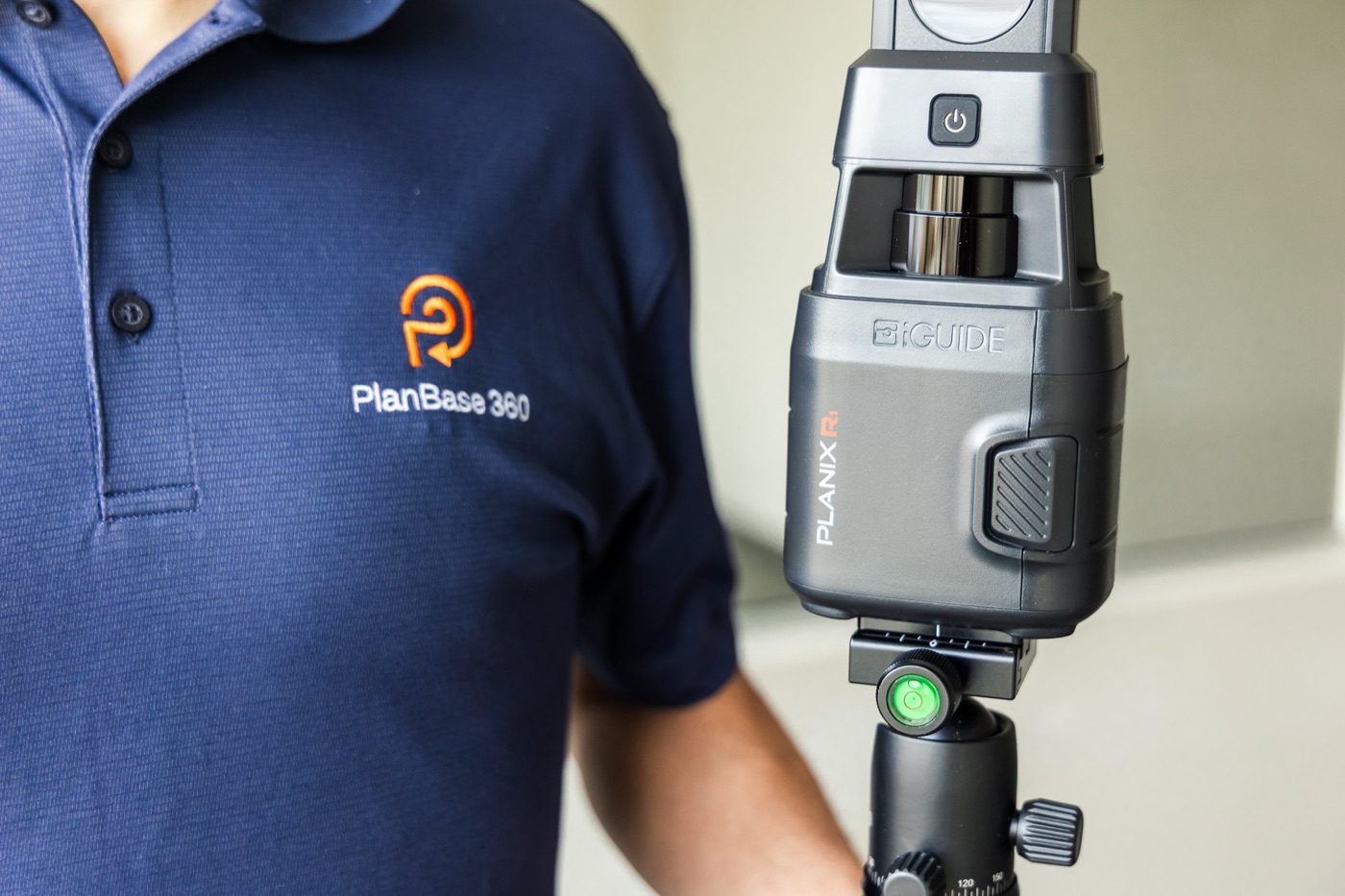
We scan with an iGUIDE PLANIX, a survey-grade system that pairs integrated LiDAR with a 60MP 360° camera. Because the imagery and the measurements are captured together and registered to each other, the resulting model is both dimensionally accurate and visually complete.
The practical consequence is that you get a measured dataset and a photographic record of the building from the same visit, rather than commissioning a scan and a photographer separately and hoping the two line up.
Accuracy figures for laser scanners are easy to compare badly, so it is worth being exact about ours. iGUIDE publishes the PLANIX as typically ±10mm from camera to wall, on walls 60cm or longer. It publishes a separate, looser figure of ±25mm for the raw point cloud out to the scanner's 40-metre range. The first describes a measured wall; the second describes every individual point the scanner records.
Range is the reason a building is scanned from many positions rather than one. A reading taken from a couple of metres away is tighter than one taken from across a deep warehouse bay, so the scanner is moved through the building and each position overlaps the last. Glass, mirrors, polished floors and strong sunlight all affect laser measurement, and setups are planned around them.
A tolerance describes the measurement, not the drawing. Somebody still drafts the plan from the captured data and decides, wall by wall, how to represent what was measured. That drafting step is where two firms using similar instruments end up handing over drawings of different quality.
The point cloud is the raw material. These are the things you actually receive.
Dimensioned, drafted plans as PDF, with area figures suitable for lease documentation and space planning.
Properly organised linework you can design over directly, rather than a traced image.
Existing-conditions geometry for BIM workflows, so the model you design in starts from reality.
Ceiling grid, heights, lighting, diffusers and sprinkler heads, all captured in the same pass.
A browser-based digital twin. Anyone on the project can revisit the site and measure it themselves.
Cut anywhere through the dataset, including interior elevations for millwork and equipment.
From booking to delivered files, in five stages, with the one thing each stage needs from you.
| Stage | What happens | What it needs from you |
|---|---|---|
| Booking | What happens: You book online and get an instant estimate. Dates are available from the next day onward, in morning, afternoon or evening windows. | What it needs from youThe address, a rough idea of the size, and which deliverables your team needs. |
| Arrival | What happens: We confirm the scope on site: which floors, rooms and areas are being drawn. | What it needs from youSomeone who knows the space, and keys or access to every room in scope. |
| Capture | What happens: The scanner is set up at one position after another through the building, recording LiDAR and 360° imagery at each. A typical commercial suite takes a few hours. | What it needs from youNothing more. Occupied buildings are routine, and staff can keep working. |
| Drafting | What happens: The positions are joined into one measured dataset, and the floor plans, CAD or Revit model are drafted from it. | What it needs from youNothing. If a question comes up, we answer it from the data rather than a return visit. |
| Delivery | What happens: Floor plans and the 3D tour arrive one to two business days after the visit; CAD and BIM within about a week. | What it needs from youWho on your team should receive the files. |
Timings are for a typical commercial scope. Larger or more detailed scopes take longer, and we say so before you book.
Three ways to document an existing commercial space, and where each one lands.
| Method | Accuracy | Coverage | Best suited to |
|---|---|---|---|
| Tape and hand sketch | AccuracyError accumulates over distance | CoverageOnly what was measured on the day | Best suited toA single small room where nothing is at stake |
| Photo-based 3D capture | AccuracyGood visual record, looser dimensions | CoverageVisible surfaces only | Best suited toMarketing and walkthroughs rather than construction documents |
| LiDAR scanning | Accuracy±10mm, consistent across the whole building | CoverageThe complete space, including what you did not think to measure | Best suited toPermit sets, CAD and BIM, area calculations, fabrication |
The distinction that matters for construction documents is whether a dimension was measured or inferred. LiDAR measures.
A tripod LiDAR scanner suits most as-built work: the drawing an architect or designer works over, a lease-area calculation, a permit set's existing conditions. It is not the answer to everything, and saying so is more useful than pretending otherwise.
Work where a few millimetres decides whether something fits, such as precision fabrication or tight equipment clearances, needs a survey-grade terrestrial scanner working to ±1–3mm. At the other end, if the only job is to show a space to someone deciding whether to visit it, a tour camera or a careful hand sketch is usually enough. The tolerance a drawing needs is set by what will be built from it, and your design team sets that figure.
The same capture applies across building types. What changes is what the drawing is used for.
Existing-conditions plans for fit-outs and refreshes, lease-area figures, and reflected ceiling plans for the trades.
Measured suites before a tenant improvement, including the kitchen, washroom and storefront conditions a design has to work around.
Room-by-room plans for clinics, where plumbing, equipment and ceiling services decide what a layout can be.
Large floorplates, clear heights and column grids, where hand measurement is at its least reliable.
Existing-conditions drawings for a renovation, addition or suite, so the architect or designer starts from what is actually built.
Drawings of an existing strata building or commercial unit where the original set is missing or out of date.
We cover Metro Vancouver and the Fraser Valley from our North Shore base, including Vancouver, Burnaby, Richmond, Surrey, Delta, Langley, Coquitlam, Port Coquitlam, New Westminster, North and West Vancouver, Maple Ridge, Mission, Abbotsford and Chilliwack.
Much of the industrial work sits in the Burnaby, Richmond, Surrey, Delta and Langley corridor, where large-floorplate warehouse and flex buildings are exactly the case that hand measurement handles worst.
PlanBase 360 laser scans existing buildings across Metro Vancouver and the Fraser Valley from a North Shore base, using an iGUIDE PLANIX LiDAR scanner. The scan is drawn into floor plans, layered AutoCAD, a Revit model and a 3D tour, and you can book online with an instant estimate.
A typical commercial suite is a few hours. Larger industrial buildings take longer, and heavily subdivided spaces with many small rooms take longer than open floor plates of the same area, because the scanner has to be set up in more positions.
The point cloud is the working dataset we draft from. What you receive is the drawings, CAD, BIM and 3D tour produced from it. If your team specifically needs the raw registered data for their own workflow, ask when you book and we will scope it.
Very little. The scanner sits on a tripod and moves from position to position, with no cabling run through the space and nothing attached to the building. We work around occupied areas and can schedule after hours where that is easier for the tenant.
iGUIDE states the PLANIX as typically ±10mm from camera to wall on walls 60cm or longer, and ±25mm across the raw point cloud to 40 metres. That suits the drawings most design, lease and permit work is built from, and it holds across a whole building rather than drifting the way a long run of hand measurements does. Work that needs a few millimetres or better calls for a survey-grade scanner.
Yes, exteriors and site context are part of a normal capture, and we add aerial photography where the building or the project calls for it.
Book online with an instant estimate. One visit produces the plans, the CAD, the model and the tour.